
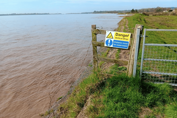
FOR centuries, people living beside the Severn have fought to keep the river off their land. At Awre, conservationists now want to reverse that struggle.
Deliberately opening a sea wall so the tides can reclaim hundreds of acres of farmland may sound like surrender, but conservationists believe it could protect the peninsula's future, even if it means permanently changing a landscape shaped by generations of farming.
The Wildfowl and Wetlands Trust (WWT) has submitted plans to transform 148 hectares, approximately 365 acres, at Guy Hall Farm into saltmarsh and other wetland habitats.
The application, now before Forest of Dean District Council, would involve breaching existing flood defences, constructing a new embankment inland and forming creeks, ponds and shallow scrapes. It is not permission to begin work.
Residents have until December 2 to comment on proposals which could eventually redraw the boundary between land and river.
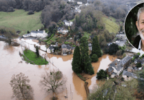
The central argument is that the Severn is already threatening to make that decision itself. Much of the site lies low enough to be covered by exceptional tides and has experienced flooding before.
WWT says the existing defences are no longer maintained and an uncontrolled failure could bring dangerous erosion, cut off access and damage trees, farmland and other features.
A planned breach, by contrast, would allow water in at a chosen point while a new protective bank safeguards land beyond the reserve.
This approach is known as managed realignment. Instead of trying to defend every metre of an increasingly vulnerable coastline, engineers move the effective line of protection further inland. Salt water then floods selected ground on rising tides and drains away as the water falls.
Over time, sediment settles, specialised plants take root and a network of muddy channels develops. It is not simply creating a permanent lake. The intention is a living landscape that changes with each tide, helping absorb wave energy before it reaches the new defences.


The project also proposes to restore something Awre once possessed. Historical maps contain field names referring to marshes and wharves, while the name Warth recalls the saltmarsh pastures of the Severn.
The Trust believes an outer wall was in place by the 1840s, excluding tidal water from land previously exposed to it. Even today, salt tolerant plants survive along the existing defences. Across the river, the marshes at Slimbridge demonstrate that this habitat can flourish so far upstream.
Recent excavations have added an intriguing chapter. Archaeological investigations uncovered a possible earlier flood bank, later overtaken by river sediment, suggesting attempts to reclaim the peninsula were not necessarily a steady march towards dry land.
A loosely cobbled trackway associated with Roman pottery was also discovered where higher ground meets the former tidal zone. Archaeologists believe it may have provided access for grazing livestock, although its precise purpose remains uncertain. Dating work on the old bank could help explain when people first tried to separate these fields from the Severn.
The modern scheme began with a £21 million donation from insurer Aviva in June 2023, supporting WWT's wider ambition to restore up to 250 hectares of saltmarsh and investigate its environmental benefits.
After examining potential sites, the charity announced an agreement to purchase the Awre land in December 2024, completing the acquisition the following January. At the time, The Forester reported that WWT deputy chief executive Kevin Peberdy envisaged a quiet local reserve, rather than another large visitor attraction like Slimbridge.
Residents had already been invited to Awre Village Hall in September 2024, before the announcement. Further meetings followed in December and throughout 2025, alongside walks on the peninsula and a visit to the Dumbles saltmarsh at Slimbridge.
Discussions have covered not only ecology but the practical details of daily life: where people might walk, whether parking is needed and what happens to familiar hedges, orchards and views. A local community forum has since been established to relay concerns and help shape designs.
Those concerns are hardly surprising. To families accustomed to seeing cattle or crops beside the river, turning productive fields into tidal habitat is a profound change.
WWT acknowledges that agricultural land will be lost in its present form, although it hopes livestock can eventually graze suitable parts of the marsh again, as happens at its Steart Marshes reserve in Somerset.
Some existing trees and hedgerows would also be affected, with replacement planting planned on higher ground. The charity says neighbouring farmland would receive protection from the new embankment. WWT plans to move heritage fruit trees, including Blaisdon Red plums and Blakeney Red pears, to higher ground in an effort to preserve local agricultural character.
Public access is another sensitive issue. The path along the present riverbank is valued by walkers, but a breach would interrupt the route and WWT argues that maintaining a bridge across it could become impractical if the ageing wall failed elsewhere.
Revised designs include an alternative circular walk on higher ground, with views over the estuary. At an April 2026 village meeting, residents were asked about paths, parking, viewpoints, signs and the future of the traditional putcher hut linked to Severn fishing.
There is also a wider Severn controversy which must not be confused with Awre. In March 2025, EDF paused separate saltmarsh proposals intended to compensate for impacts on fish from Hinkley Point C.
Those plans had faced opposition at places including Arlingham and Rodley, with residents welcoming the decision. EDF said emerging acoustic fish deterrent technology could offer another solution.
The Forester reported that Westbury councillor Simon Phelps described the pause as a great relief. It did not halt WWT's independently funded Awre restoration, which continued through surveys and local consultation.
Supporters believe the reward would reach well beyond flood management. Saltmarshes provide feeding grounds for wading birds, wintering wildfowl and countless invertebrates. Their vegetation traps sediment and carbon can remain locked within waterlogged soils, making restoration potentially valuable in tackling climate change.
WWT plans to study those benefits rather than simply assume them. Surveys have examined birds, mammals, reptiles, water quality and the land's archaeological remains, establishing a baseline against which future changes can be measured. New fixed photography posts will also record changes to the landscape as the restoration progresses.
Questions remain about the wider river. Residents have asked whether altering the shoreline could affect tidal currents or the Severn Bore. WWT says modelling by consultants Jacobs indicates negligible changes to currents elsewhere in the estuary and no significant effect on extreme water levels.
Its initial assessment also suggests the Bore should continue normally because the wave passes the proposed opening before water begins filling the site. These are modelling conclusions, not guarantees, and detailed environmental evidence forms part of the planning process.
The timetable has already moved beyond early expectations. WWT's current programme anticipates construction during 2027 and 2028, with the actual breach planned for summer or autumn 2028, subject to consent and further design work.
A community walk and village hall drop-in are scheduled for November 24, giving residents another opportunity to scrutinise what is proposed. The council's decision is still to come.
For Awre, the underlying question is bigger than a planning application: whether living with the Severn, rather than endlessly resisting it, might preserve more of what makes the peninsula special.
Comments
We've recently changed our login process. If you have an account for commenting, you will need to re-register on the login window.
This article has no comments yet. Be the first to leave a comment.